Nature’s contributions to people: a multi-scale perspective
People obtain many benefits from ecosystems (sometimes called ecosystem services (ES) or nature’s contributions to people (NCPs)). As NSERC ResNet researchers, we have studied these benefits at different scales. This story map provides a summary of some of our work related to scales and the lessons we have learned.
Taking a multi-scale perspective means that we can measure things at fine or small scales, for example measuring carbon in a handful of soil, or at broad or large scales, for example when studying a landscape of fields and forests. For the latter, we can use techniques like remote sensing that give us a bird’s-eye perspective of larger ecological patterns and processes.
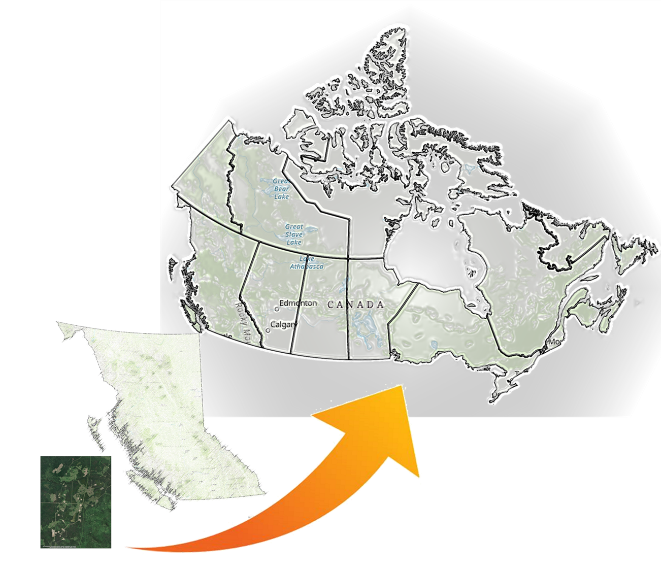
We are part of NSERC ResNet, a network which unites a broad community of scholars, nongovernmental organizations, government agencies, and industry sectors. We work in different regions of Canada, with the common goal of improving how we monitor, model, and manage NCPs. In the next sections we:
- define what we mean by spatial and temporal scales,
- discuss the importance of taking a multi-scale perspective, and
- introduce a few challenges and best practices related to scaling.
We acknowledge the support of the Natural Sciences and Engineering Research Council of Canada (NSERC), [funding reference number NSERC NETGP 523374–18].

Cette recherche a été financée par le Conseil de recherches en sciences naturelles et en génie du Canada (CRSNG), [numéro de référence NSERC NETGP 523374–18].
Contents
Introduction
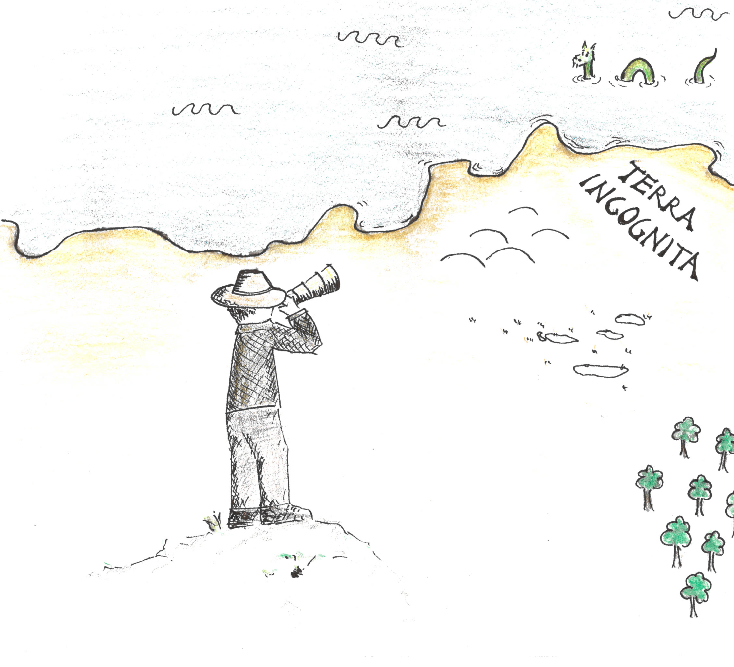
Scientists often work at different scales to analyze different parts of a landscape or ecosystem. We can study ecosystems at different scales across space (i.e., spatial scale) or across time (i.e., temporal scale).

Importance of field sampling
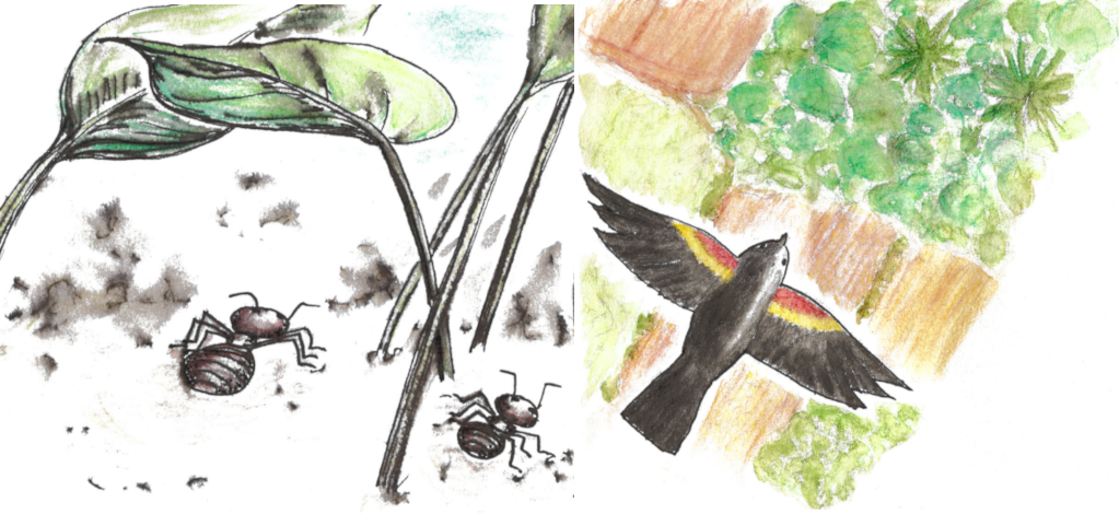
Field studies (e.g., measuring ecosystems directly) seek to capture as much detail in time and space as possible, given the question and the availability of time and funds. In this example we show the origin story of collecting field data and explain why collecting field data takes time, creativity, and perseverance.
Spatial resolution matters
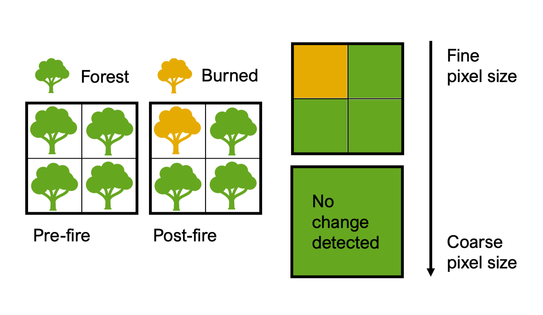
We often need detailed data to detect change. In this example, we discuss why we need data at finer pixel sizes to detect forest losses and gains.
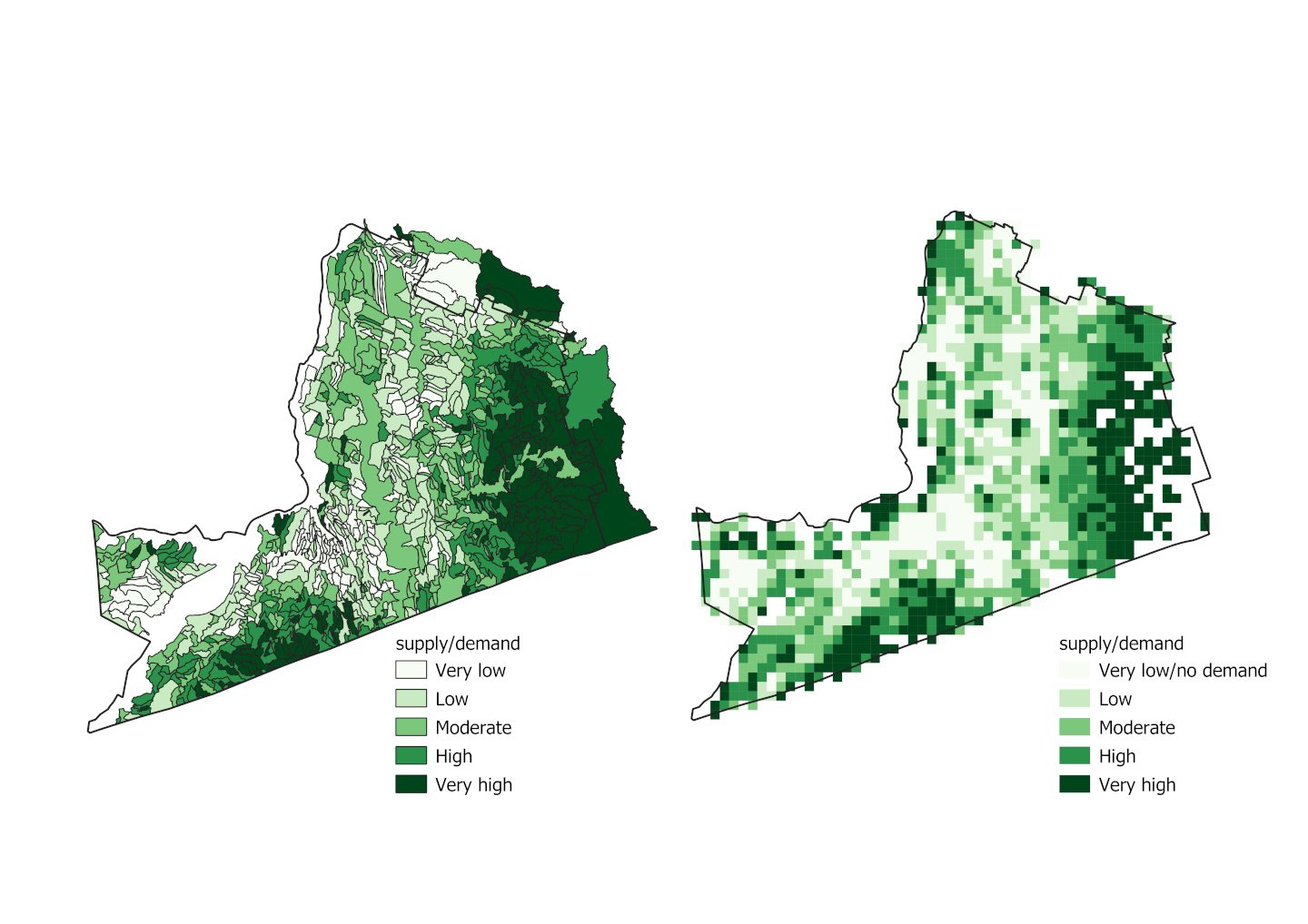
The choice of scale for summarizing data
We often report data by summarizing individual information (e.g., at a pixel) to coarser scale analysis units (e.g., census division). In this example, we discuss the consequences of summarizing data to different units.
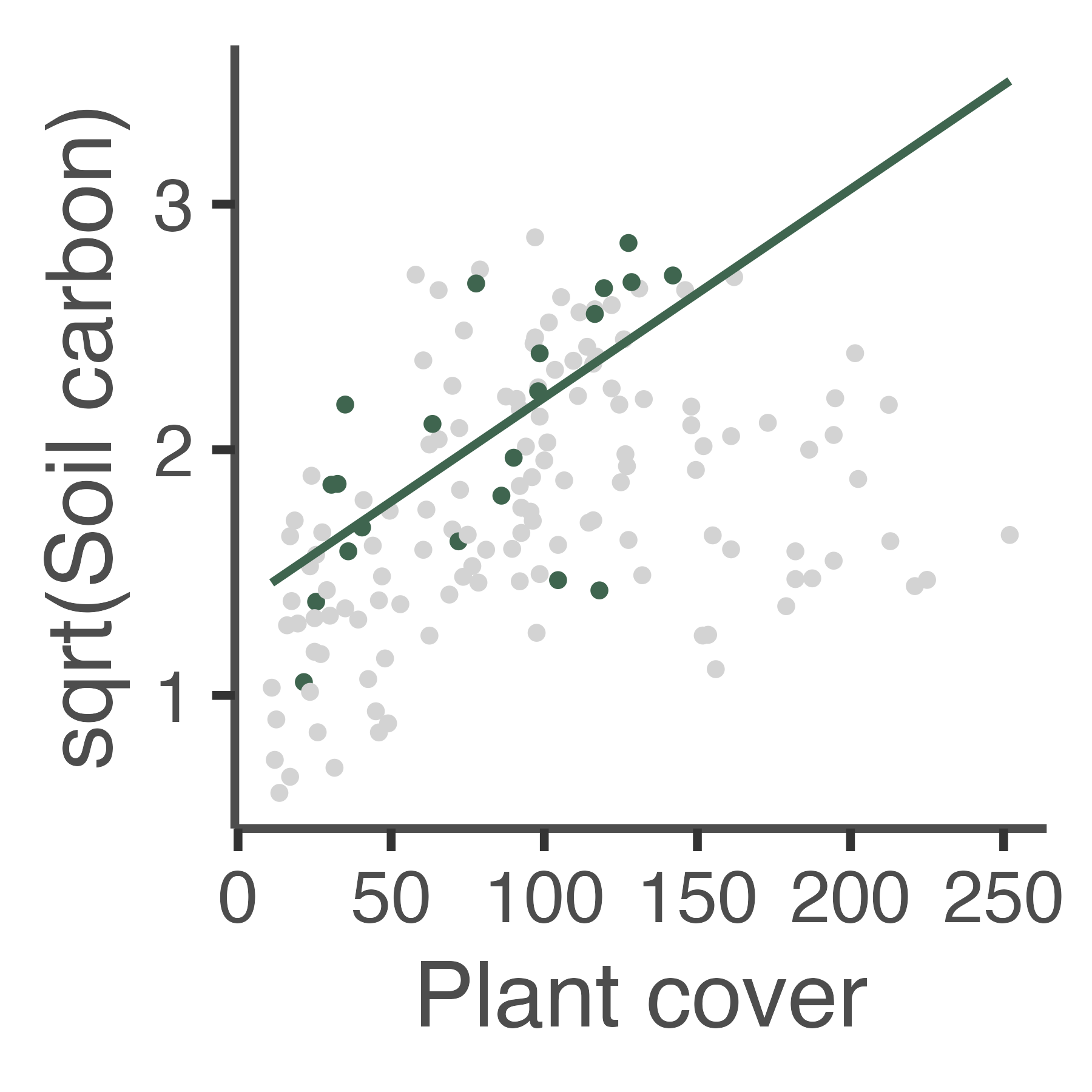
Making good predictions
Relationships may differ over time or space. This example discusses the consequences of generalizing our results outside of the original study area.

Time period matters
To understand whether an ecosystem is changing, we measure it over time. However, if we only measure the ecosystem over a short time, then we may not detect a change, even when the ecosystem has changed. This example explores how the monitoring time-period influences outcomes.
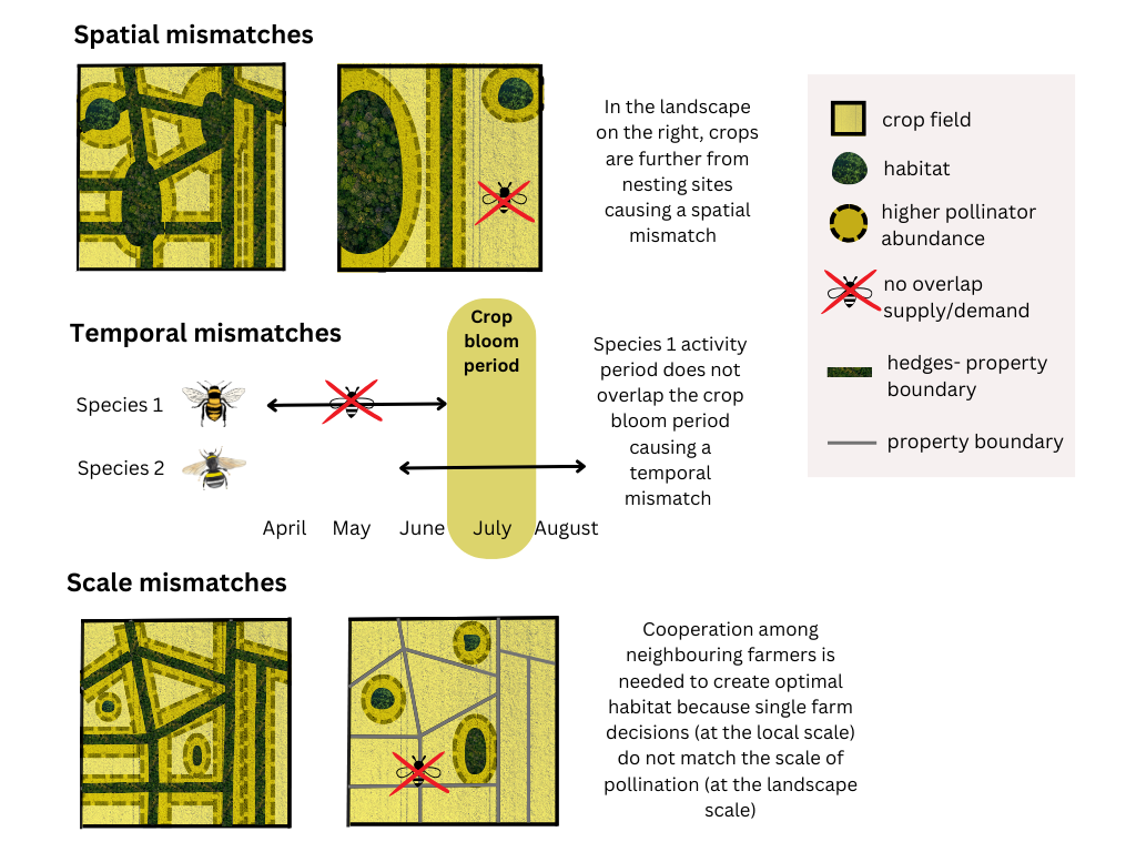
Spatial, temporal, and scale mismatches
Sometimes, the need for an ecosystem service and the ability of the environment to provide that service don't match up. Here we discuss mismatches occurring across space, time and scale.

The future is not like the past
Researchers often ask how far back in time should I go or how far forward should I forecast? Do I only care about annual changes, or do I want to know about changes within years? This example discusses how the future is not like the past.
Modelling at different scales
When selecting the level of detail to conduct research, scientists must balance between the generalizability, complexity, accuracy, and spatial extent of the analysis. As an example, the evaluation of the Human Footprint on ecosystems varies at multiple scales.
Conclusion
Things change as we change scales. Environmental processes & properties can shift as we change scales — whether in terms of spatial or temporal resolution and extent.

References
List of references used in this story map.

Glossary
Did you find some difficult-to-understand jargon in this story map? It’s likely that you did, and for that reason we made this glossary of some fancy scientific terms, to help you navigate this story map.