Introduction
Authors: Amanda Schwantes, Ágnes Vári, Yiyi Zhang, Gabriela Maria Torchio, Poliana Mendes
Background
Scientists often work at different scales to analyze different parts of a landscape or ecosystem. We can study ecosystems at different scales across space (i.e., spatial scale) or across time (i.e., temporal scale). We can also ask “how big?” (i.e., what is the extent?) or “how much detail?” (i.e., what is the resolution?).
Spatial and temporal scales
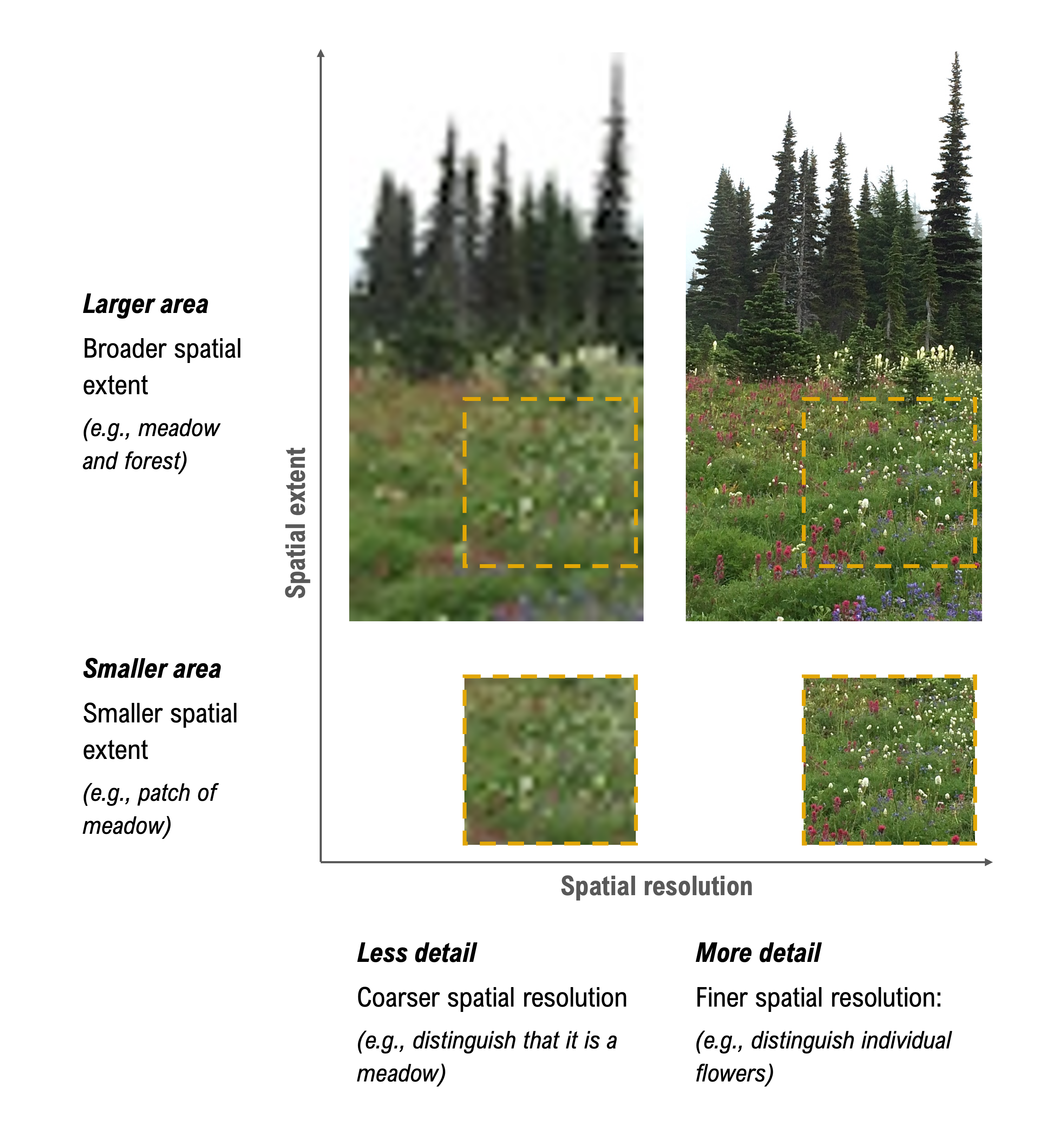
When we move from the bottom to the top images below, we are increasing the size of the study area (i.e., spatial extent). When we move from the left to the right images below, we are increasing the number of pixels per area (i.e., spatial resolution), which allows for individual flowers to be distinguished.
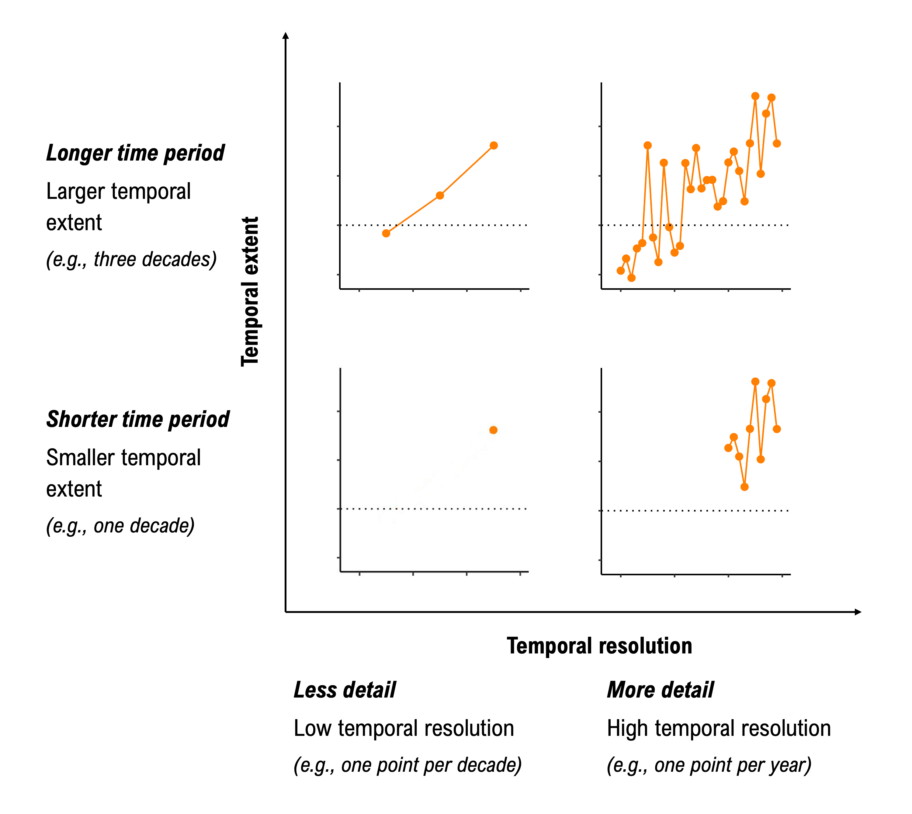
In the image below, when we move from the bottom to the top images, we are expanding the time period for which we are collecting data. When we move from the left to the right images, we are increasing the detail (e.g., number of data points per year).
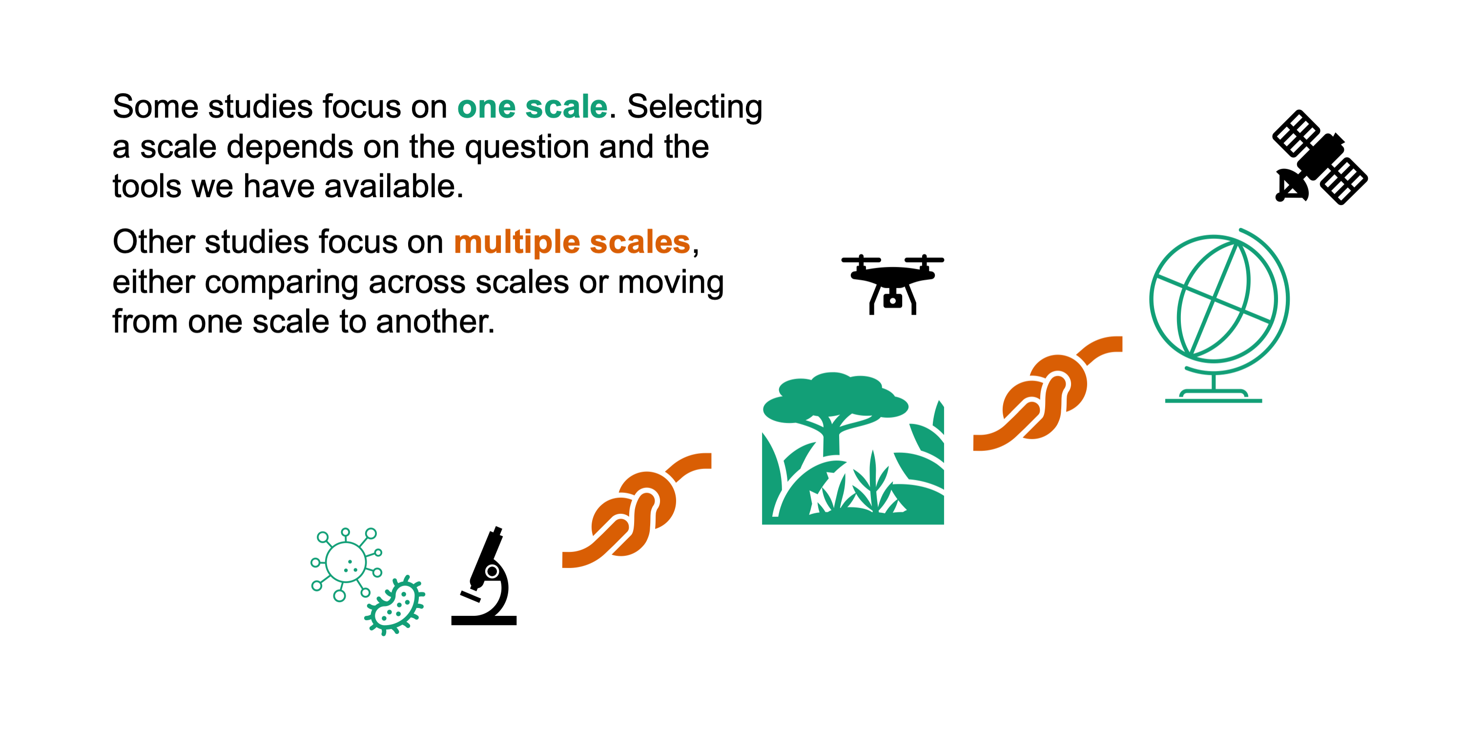
A multi-scale perspective
As scientists and researchers, we often design studies at different scales, because:
- decision-makers require data at different spatio-temporal scales,
- scientists seek to understand how ecosystem processes and properties vary across scales, and
- there are cost and time constraints to collecting data; therefore, we target the scale most relevant for a given question or decision.
Sometimes data is only available (or can only be collected) at one scale; however, we may need information at a different scale to inform a decision or to understand an ecological process. We may scale up or down for many reasons, including…
- it can be expensive, time-consuming, and dangerous to collect data in the field at every possible location. Instead, we divide a larger landscape into smaller similar areas and take representative samples within each group.
- ecological processes can be difficult to observe directly, including when processes are too fast, too slow, too small, or too large. We develop models to visualise a reality that is inaccessible to our senses.
- management and policy decisions may require data and/or information at a different scale compared to the scale of available data. For example, while the implementation of a municipality management plan may require data at the level of neighbourhoods, research models, which are usually run over broad extents, require data with regional or national coverage.
- sometimes data is only available for a large region but we may need data at a finer resolution to answer key questions. For example, we may want to know how many people within city neighbourhoods or villages live along a river prone to flooding. However, we may only have population data at the larger city or county levels.
Moving between scales: challenges and opportunities
Sometimes we move between scales, which creates key challenges and opportunities. For example, the methodological choices we make at a given scale can lead to misleading results as we extend our research to other scales. In this story map, we illustrate many of these challenges and provide opportunities for overcoming them.
